Regulatory Agency Approvals & Permitting
Whether your project involves town boards, or state and federal agencies, our extensive experience provides clients with guidance through the most complex government approvals.
Drainage Studies
BME Associates can identify and analyze the complex implications that stormwater has on a community, quantify stormwater scenarios, identify drainage characteristics, and prepare a management plan to mitigate development improvements.
Drainage studies services include:
- Watershed Analysis
- Stream Profiling
- Culvert Capacity Calculations
- Stormwater Management Plans
Floodplain Analysis and Mapping
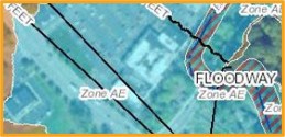
Electronic Letter of Map Amendment (eLOMA) allows us to have your structure and/or entire property removed from the Special Flood Hazard Area (SFHA), when applicable. A flood elevation certificate may help lower your flood insurance premiums.
Floodplain Frequently Asked Questions
Land Planning
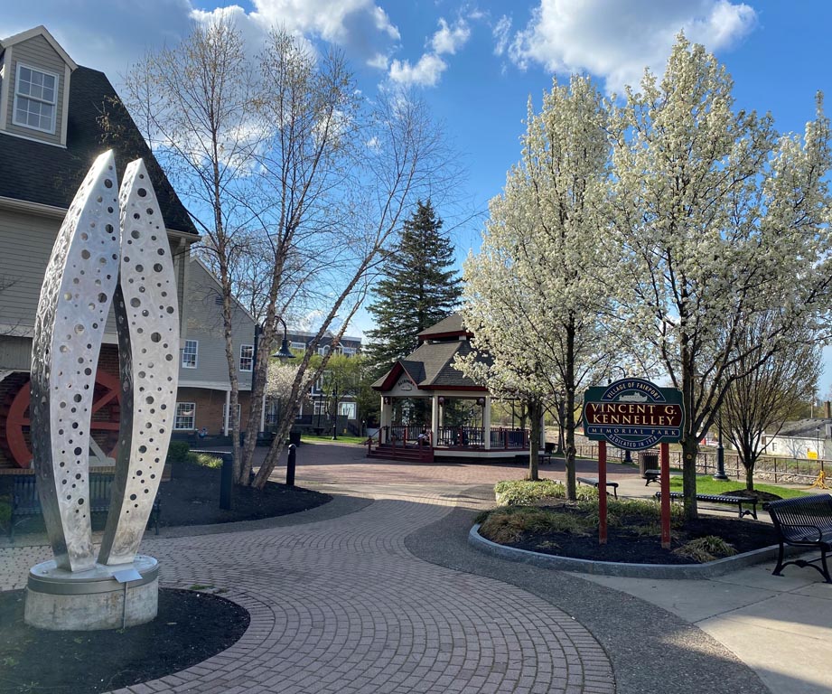
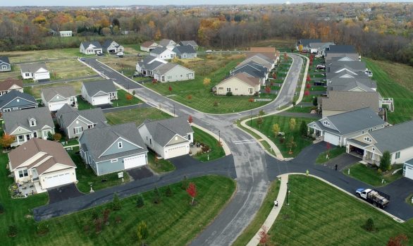
We offer design solutions that are sensitive to site complexities while maintaining an economic practicality critical to our clients. We have more than 25 years’ experience in community and land planning and can provide innovative design solutions, guide a project though market realities, and create lasting, attractive communities with real value.
Land Planning Services
- Land Use and Community Planning
- Site Development Feasibility
- Recreational Design, Open Space, and Park Planning
- Natural Resource Inventory Assessment
- Site Planning and Site Engineering
- Comprehensive Plans
- Community Master Plans
- SEQRA/Environmental Review Services
- Comprehensive Stormwater Management Planning
- Floodplain Analysis and Mapping
- Green Infrastructure
- Infill Development
- Mixed-Use Planning
- Strategic Planning
- Project Presentations and Public Interfacing Meetings
- Streetscape and Corridor Design
Landscape Architecture
BME provides Landscape architectural services for a wide range of project types, including park planning, golf course planning and design, athletic facilities, open space planning, and trail mapping.
Our creative design approach provides clients with projects which are reflective of their desire to establish a competitive advantage over the competition.
Landscape Architecture Services
- Project Presentations, Public Interfacing, and Visioning
- Community Amenities Design
- Streetscape and Public Realm Planning and Design
- Recreational Design, Open Space and Park Planning
- Trails and Greenway Mappings, Studies and Design
- Tree and Plant Survey
- Identity/Wayfinding/Signage Design
- Hikeway/Bikeway Mapping and Design
- Multi-Use Trail Design
UAS (Drone) Surveys
As BME Associates continues to strive to be leaders in technology and innovative solutions for all of your projects, our survey team has moved into the fast paced and highly-efficient realm of utilizing Unmanned Autonomous/Aircraft Systems (UAS), better known as drones, in an effort to complete a more economic deliverable, as well as providing extended client value we continue to discover and share every day. We currently have 3 FAA Certified Remote Pilots on staff.
- Topographic Surveys
- Up-to-Date Orthomosaic Photos
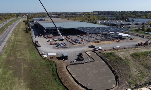
- Construction Progress
- Video Recording of Project Sites for Visual Observations
Boundary and Right-of-Way Surveys
BME Associates offers comprehensive land survey and mapping services for a broad range of applications and purposes through an integrated approach to the measurement, analysis and management of locations and descriptions of survey data. We’ve earned the trust of our clients and partners by exceeding expectations on everything from small, public-sector land surveys, to large and complex developments.
Our ALTA/NSPS Land Title Survey Services include surveys for the full range of property and project types from rural to urban and undeveloped to developed.
Flood Certificates and Flood Map Amendments
BME’s survey team approach projects with experience in regulations, processes, and communication making tasks run efficiently. Our land surveyors, field crew and mapping personnel are educated and thoroughly expert trained in: worksite safety, CADD configuration and specifications, and are equipped with the current survey/ mapping/GIS instrumentation, software and technology.
Electronic Letter of Map Amendment (eLOMA) allows us to have your structure and / or entire property removed from the Special Flood Hazard Area (SFHA) when applicable. A flood elevation certificate may help lower your flood insurance premiums.

Floodplain Frequently Asked Questions
Topographic Surveys
Surveys for the complete range of needs, from large undeveloped parcels to existing commercial sites with significant planimetric detail.
We now offer topographic surveys via Unmanned Aerial Systems to meet all of your surface modeling needs. Whether it’s site contours for engineering design work, repeat flights for volume calculations of stockpiles, topsoil removal calculations, or post earthwork verification, or for mapping tough and unsafe site conditions, our FAA Certified Remote Pilot will get you to where you want to be.
Construction Stakeout
Services include stakeout for initial clearing and earthwork phases of a development project, through final stakeout for roadways, buildings, parking, and utilities.
Our field crews are able to take advantage of the latest developments with GPS and real time layout and grading. We are also capable of preparing and providing software models for all of your machine control needs.
Horizontal and Vertical Control Surveys
Cost-effective monitoring of structural walls, floors, and foundations for possible horizontal and vertical movement.
Environmental Mapping
- Wetlands
- Woodlots
- Flood Hazard Areas
- Factors affecting development as defined by Federal, State, and local laws
Additional Surveying Services
- Legal Descriptions
- Easement Maps
- Conveyance Maps
- Profiles & Cross-Sections
- Volumetric Calculations
- Excavation & Mining Related Mapping
- Survey Site Control for Projects Utilizing Machine Control Construction
- Pond Surveys & Volume Calculations
- KMZ File Generation for Boundary, As-Builts, Subdivisions
Contract Administration
- Construction Statement Review and Quantity Verification
- Letter of Credit Administration
Private & Municipal Construction Observation
Monitoring and reporting during construction gives an owner and municipal agencies a sense of on-site representation.
We will routinely review drawings, keep daily logs, and work closely with contractors, owner’s reps, and governing agency staff to benefit job progress.
Record Mapping & Reporting
Our construction services team puts the finishing touches on a successful construction phase by providing or reviewing “Punch List “ items that may need attention prior to payment, dedication of facilities, or for release of retainages.
Preparation and submittal of “Record Maps” in a format required by municipalities by providing a permanent record of the project and invaluable resource for future development.
Wetland Services
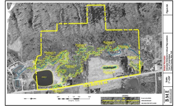
Successful compliance with Federal, State and local environmental regulations and documentation is a process that requires navigation with expert understanding, strategic approaches and creative solutions.
Our dedicated staff have established an excellent reputation with environmental agencies, while delivering customized solutions to the complex environmental challenges that our clients’ face.
Wetland Services Include:
- Stream Cleaning Permitting
- Field Wetland Delineations and Reports
- NYSDEC/USACE Liaison
- Stream Restoration
Floodplain Analysis & Mapping
BME has experienced staff capable of extensive technical study required by FEMA for creating floodplain map amendments and revisions.
Electronic Letter of Map Amendment (eLOMA) allows us to have your structure and/or entire property removed from the Special Flood Hazard Area (SFHA), when applicable. A flood elevation certificate may help lower your flood insurance premiums.
 Floodplain Frequently Asked Questions
Natural Resources Services
- Natural Resources Inventory
- Flora and Fauna Surveys
- Endangered and Threatened Species Surveys
- Steep Slope Analysis & Erosion Mitigation
- State Environmental Quality Review Act Investigations (SEQRA)
State Environmental Quality Review (SEQR) Services
BME Associates has a high success rate, and established strong relationships with environmental regulatory agencies for almost 30 years—most notably State and Federal Wetlands agencies and departments. We can help you successfully navigate throughout the SEQR process.
Whatever your situation, our environmental engineering staff can guide you to gain full regulatory compliance to achieve your project’s goals.
SEQR Services:
- Preparation of Formwork
- Supplemental Information
- Preparation of Environmental Impact Statements
- Compliance with SEQR Regulation
General
- Stormwater Management Program Plan Development
- DEC/EPA Audit Assistance
MCM 1 Public Education & Outreach
- SWMPP Development
- Educational Brochures
- Flyers & Handouts
- Newsletters
- Social Media Posts
MCM 2 Public Involvement & Participation
- MS4 Annual Report Presentation
- Storm Drain Marking Program
- Social Media Posts
- Enviroscape Model Demo
- Organizing Clean Ups
MCM 3 Illicit Discharge Detection & Elimination (IDDE)
- Outfall Mapping
- Outfall Inspections
- Annual IDDE Training
- Standard Operating Procedures
MCM 4 Construction Site Stormwater Runoff Control
- Stormwater Pollution Prevention Review (SWPPP) for MS4 Acceptance
- Pre-construction Meeting Attendance
- Construction Site Compliance Inspections
- Construction Site Inventory
- SWPPP Enforcement & Notices of Violation
- Inspection Frequency Reduction & Notice of Termination Verification
MCM 5 Post-Construction Stormwater Management
- SWPPP Review & MS4 Acceptance
- Post-Construction Control Inventory
- Post-Construction Control Inspections
- Post-Construction Control Mapping
- SWMF Operation & Maintenance Plans
- Low Impact Development, Better Site Design & Green Infrastructure Training
MCM 6 Pollution Prevention & Good Housekeeping
- Facility Inventory & Assessments
- High Priority Facility SWPPPs
- Standard Operating Procedures
- Best Management Practices
- Annual Pollution Prevention (P2)/Good Housekeeping Training

