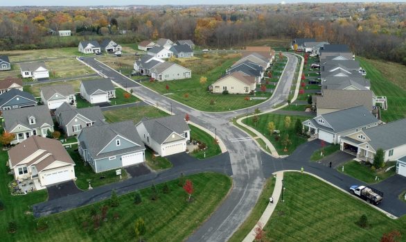
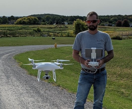
As BME Associates continues to strive to be leaders in technology and innovative solutions for all of your projects, our survey team has moved into the fast paced and highly efficient realm of utilizing Unmanned Autonomous/Aircraft Systems (UAS), better known as drones, in an effort to complete a more economic deliverable as well as providing extended client value we continue to discover and share every day. We currently have three FAA Certified Remote Pilots on staff.
- Topographic Surveys:
- Meet or exceed horizontal accuracy to within 0.1 feet
- Meet or exceed vertical accuracy to within 0.2 feet
- Field time reduced by up to 50% to acquire data
- Field personnel safety on busy roadways, dangerous slopes, mining pits, etc.
- Up-to-Date Orthomosaic Photos:
- Never revisit a site because field crews forgot to locate something
- Design engineers, clients and managers see real time, real world site conditions with high quality images
- Construction Progress:
- Daily, weekly, monthly flyover video of project sites for project team review
- Earthwork volume verification
- Topsoil pile calculations
- Video Recording of Project Sites for Visual Inspection and use by:
- Traffic Engineers in road widening projects
- Project team and client collaboration
- Municipal authorities and approval agencies
- Visual inspection of buildings, stacks, and towers
- Real time photos to review views, especially lake views, from proposed house and building locations. We can take you each window and deck location.
BME Associates offers comprehensive land survey and mapping services for a broad range of applications and purposes through an integrated approach to the measurement, analysis and management of locations and descriptions of survey data. We’ve earned the trust of our clients and partners by exceeding expectations on everything from small, public-sector land surveys, to large and complex developments.
Our ALTA/NSPS Land Title Survey Services include surveys for the full range of property and project types from rural to urban and undeveloped to developed.
When working with BME’s survey team you are working with decades’ worth of combined experience and a reputation for high quality, responsiveness and professionalism.
Our extensive experience in providing a broad range of services to private and public clients ranges from lot surveys required for purchasing or refinancing a home, boundary surveys of large tracts for development, or topographic surveys for municipal projects.
Instrument surveys for real estate closings are completed to the standard of care as established by the New York State Association of Professional Land Surveyors, as well as the standards, as adopted in 2017, by the Genesee Valley Land Surveyors Association.
BME’s survey team approach projects with experience in regulations, processes, and communication making tasks run efficiently. Our land surveyors, field crew and mapping personnel are educated and thoroughly expert trained in: worksite safety, CADD configuration and specifications, and are equipped with the current survey/ mapping/GIS instrumentation, software and technology.
Electronic Letter of Map Amendment (eLOMA) allows us to have your structure and / or entire property removed from the Special Flood Hazard Area (SFHA) when applicable. A flood elevation certificate may help lower your flood insurance premiums.
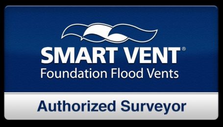
BME is a SMART VENT Authorized Surveyor
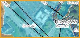
Floodplain Frequently Asked Questions
Surveys for the complete range of needs, from large undeveloped parcels to existing commercial sites with significant planimetric detail.
We now offer topographic surveys via Unmanned Aerial Systems to meet all of your surface modeling needs. Whether it’s site contours for engineering design work, repeat flights for volume calculations of stockpiles, topsoil removal calculations, or post earthwork verification, or for mapping tough and unsafe site conditions, our FAA Certified Remote Pilot will get you to where you want to be.
Services include stakeout for initial clearing and earthwork phases of a development project, through final stakeout for roadways, buildings, parking, and utilities.
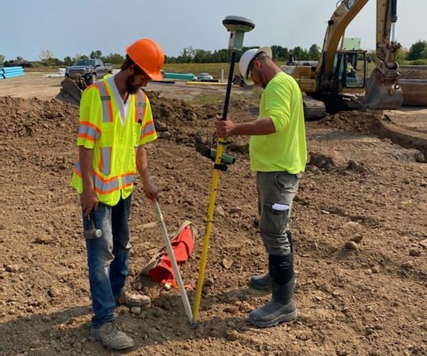
Our field crews are able to take advantage of the latest developments with GPS and real time layout and grading. We are also capable of preparing and providing software models for all of your machine control needs.
Cost-effective monitoring of structural walls, floors, and foundations for possible horizontal and vertical movement.
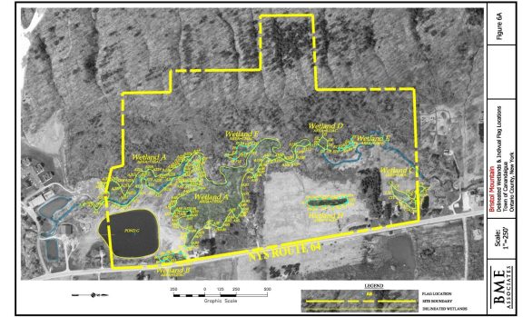
- Wetlands
- Woodlots
- Flood Hazard Areas
- Factors affecting development as defined by Federal, State, and local laws
Clients turned to us repeatedly for our accuracy, short turnaround times, and our records archives, which contains thousands of documents dating back 50 years.
Most notable, we acquired the Wayne County survey and mapping files of Shelley Associates, Kreiling Associates, P.E., L.S., Donald B. Schwartz, L.S., Edward Cook, L.S., and the Ontario County survey and mapping files of Clark Surveyors and Leonard Gardner, L.S., increasing our records database.
From the field, crews maintain digital contact utilizing the most modern mobile technology and additional capabilities such as LiDAR allowing us to support your project requiring extreme accuracy.
- Legal Descriptions
- Easement Maps
- Conveyance Maps
- Profiles & Cross-Sections
- Volumetric Calculations
- Excavation & Mining Related Mapping
- Survey Site Control for Projects Utilizing Machine Control Construction
- Pond Surveys & Volume Calculations
- KMZ File Generation for Boundary, As-Builts, Subdivisions
- Drone services for photography, site modeling, topographic modeling & construction documentation
- Authorized SMART VENT Surveyor