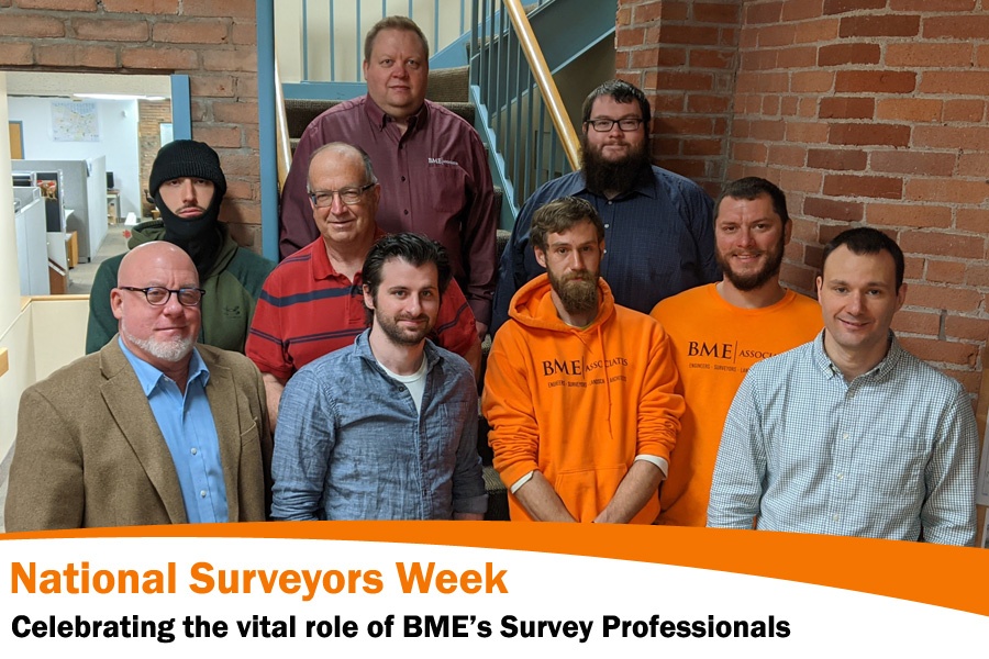
The week of March 20-26, 2022 has been set aside as National Surveyors Week, sponsored by the National Society of Professional Surveyors (NSPS). The annual week-long celebration places a priority on recognizing the land surveying profession and highlighting the role of land surveyors in today’s society.
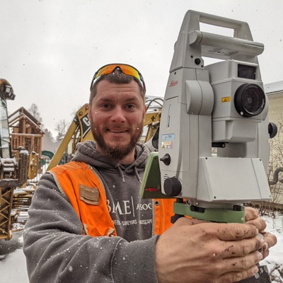
The land surveyors at BME play an integral role in the design and development process of almost every project that we take on. Our land surveyors provide a wide range of services including boundary surveys for property conveyances, title document research, deed interpretation, ALTA/NSPS Land Title Surveys, easement mapping, proposed legal descriptions, topographic surveys, elevation certificates, and FEMA Letter Of Map Amendment (LOMA) to remove the need for flood insurance. They also provide construction stake-out and utility as-built location surveys to support active construction projects.
Land surveying as a profession has grown and progressed with technological advances that have increased precision and accuracy. Land surveying has been around as long as land has been bought, sold, claimed, or otherwise fought over. Land surveying tools and techniques used in ancient times have evolved with the development of more scientifically advanced and technically precise instrumentation and implementation.
Steel tapes (used to measure distances along the ground) were used as recently as 30 years ago and have largely been replaced with Electronic Distance Measurement (EDM) instruments. EDM is used daily in the building, construction, map-making, and real estate industries. EDM works by emitting an infrared light which bounces off a target and returns to the source. This infrared light can be used to determine distances between objects. EDM equipment is frequently linked to data collectors, so measurements and other results do not have to be manually noted. This not only saves many hours of time, but it renders results infinitely more accurate because it eliminates any chance of human error in recording the data.
The use of GPS has had a significant impact on surveying by increasing the speed of measuring and locating features that are used in creating a survey map. Using a satellite to pinpoint the location of objects on the ground opens up a whole new level of land surveying because line of sight is no longer necessary for measuring. The time it takes to complete a job using GPS can be a fraction of the time the job took before this technology was available.
Unmanned Aerial Vehicles (UAV) or drones are now commonly used to quickly gather large amounts of information with a very high degree of detail in order to create digital elevation models, ortho imagery and point clouds.
Use of Lidar (Light Detection and Ranging) has become increasingly useful. Lidar is a remote sensing method used to examine the surface of the earth. Lidar systems allow scientists and mapping professionals to examine both natural and manmade environments with accuracy, precision, and flexibility.
BME Associates celebrates our team of survey professionals.
Did you know these Famous Americans were Land Surveyors?
George Washington
One of America’s most famous (and earliest) land surveyors is George Washington himself. The young future president got his bright start at the age of 17 in 1749. It was not long until he was appointed to be the Surveyor General for Virginia. Washington actually played an essential role at this time, because surveying the land promoted expansion westward.
Daniel Boone
As an American pioneer and explorer from Kentucky, Daniel Boone resolved settler’s claims to land. The legend was known to have spent much of his time traveling around the American frontier. In spite of the fact that he had no formal schooling, Boone went on to become an expert tracker by the time he was a teenager. In the years following, he took to land surveying.
Thomas Jefferson
George Washington wasn’t the only president to work as a land surveyor. Thomas Jefferson was appointed to work as the Albermarle County surveyor in Virginia in 1773. He also promoted surveying by sending Lewis & Clark on their expedition to explore the land gained through the Louisiana Purchase.
Henry David Thoreau
Though most might know of Thoreau as an author, he actually became a land surveyor in the 1850s before he published his books. Being a surveyor allowed Thoreau to use his career to facilitate his hobby. Thoreau used his observations to journal his ideas.
Benjamin Banneker
As a self-taught African-American mathematician and land surveyor, Benjamin Banneker was remarkably successful. In 1789, Washington even appointed Banneker to be part of the team surveying the future site of Washington, D.C. The project took about two years.
Abraham Lincoln
The nation’s 16th president got his start as a self-educated man in Kentucky. He worked as a storekeeper and postmaster in addition to surveying land and studying law at the same time. It is clear that Lincoln was a man with a great deal of talent and many skills, seeing how much time he spent participating in different types of work before he became president.
William Clark & Meriwether Lewis
Lewis and Clark were tasked with some of the most intensive land surveying in American history. While Lewis had a reputation as more of a planner, Clark was an expert land surveyor and mapmaker. Together, the partners traveled across the land then known as the Louisiana Purchase, making their way to Oregon to scout it out.[/vc_column_text][/vc_column][/vc_row]